Raglan (Raglan)
Raglan (Whāingaroa or Rakarana) is a small beachside town located 48 km west of Hamilton, New Zealand on State Highway 23. It is known for its surfing, and volcanic black sand beaches.
The Ngāti Māhanga iwi occupied the area around Raglan in the late 18th century. There are at least 81 archaeological sites in the area, mainly near the coast. Limited radiocarbon dating puts the earliest sites at about 1400AD. The Māori people named the site Whaingaroa ("the long pursuit"). One tradition says that Tainui priest, Rakataura, crossed Whāingaroa on his way to Kāwhia. Another says it was among the places the early Te Arawa explorer, Kahumatamomoe, with his nephew Īhenga, visited on their expedition from Maketū. The first Europeans to settle in the area, the Rev James and Mary Wallis, Wesleyan missionaries, were embraced and welcomed by local Māori in 1835. European settlement, including large scale conversion of land to pasture, began in the mid-1850s after a large sale of land by Chief Wiremu Neera Te Awaitaia.
The name "Raglan", adopted in 1858, honours Fitzroy Somerset, 1st Lord Raglan (1788–1855), who had commanded the British forces in the Crimean War of 1853–1856.
The Raglan economy initially featured flax and timber exports, followed by farming which remains the mainstay of the area.
Raglan's first coach link to Hamilton began in 1880 and a telegraph wire was put up beside the road in 1884. In 1904 Raglan was linked to Hamilton telephone exchange. Mains electricity came in 1935 and a sewage scheme in 1977.
Tourism and the arts are significant contributors to the current economy. Raglan and District Museum contains historic artefacts and archives from the region. A new museum building was built in 2011.
Map - Raglan (Raglan)
Map
Country - New_Zealand
 |
 |
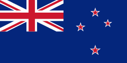
| Flag of New Zealand | |
The islands of New Zealand were the last large habitable land to be settled by humans. Between about 1280 and 1350, Polynesians began to settle in the islands and then developed a distinctive Māori culture. In 1642, the Dutch explorer Abel Tasman became the first European to sight and record New Zealand. In 1840, representatives of the United Kingdom and Māori chiefs signed the Treaty of Waitangi, which in its English version declared British sovereignty over the islands. In 1841, New Zealand became a colony within the British Empire. Subsequently, a series of conflicts between the colonial government and Māori tribes resulted in the alienation and confiscation of large amounts of Māori land. New Zealand became a dominion in 1907; it gained full statutory independence in 1947, retaining the monarch as head of state. Today, the majority of New Zealand's population of 5.1 million is of European descent; the indigenous Māori are the largest minority, followed by Asians and Pacific Islanders. Reflecting this, New Zealand's culture is mainly derived from Māori and early British settlers, with recent broadening of culture arising from increased immigration. The official languages are English, Māori, and New Zealand Sign Language, with the local dialect of English being dominant.
Currency / Language
| ISO | Currency | Symbol | Significant figures |
|---|---|---|---|
| NZD | New Zealand dollar | $ | 2 |
| ISO | Language |
|---|---|
| EN | English language |


